UpCanyon

What's it like up there?

Don't guess. Look.

Live cameras, real weather stations, radar nowcasts, snowpack, and rivers — for the drive up the canyon, the trailhead, and the places forecasts usually lie about.

No ads
No selling your location
No auto-renew tricks
No notification spam
Coming soon to iOS & Android Join the beta
The tour
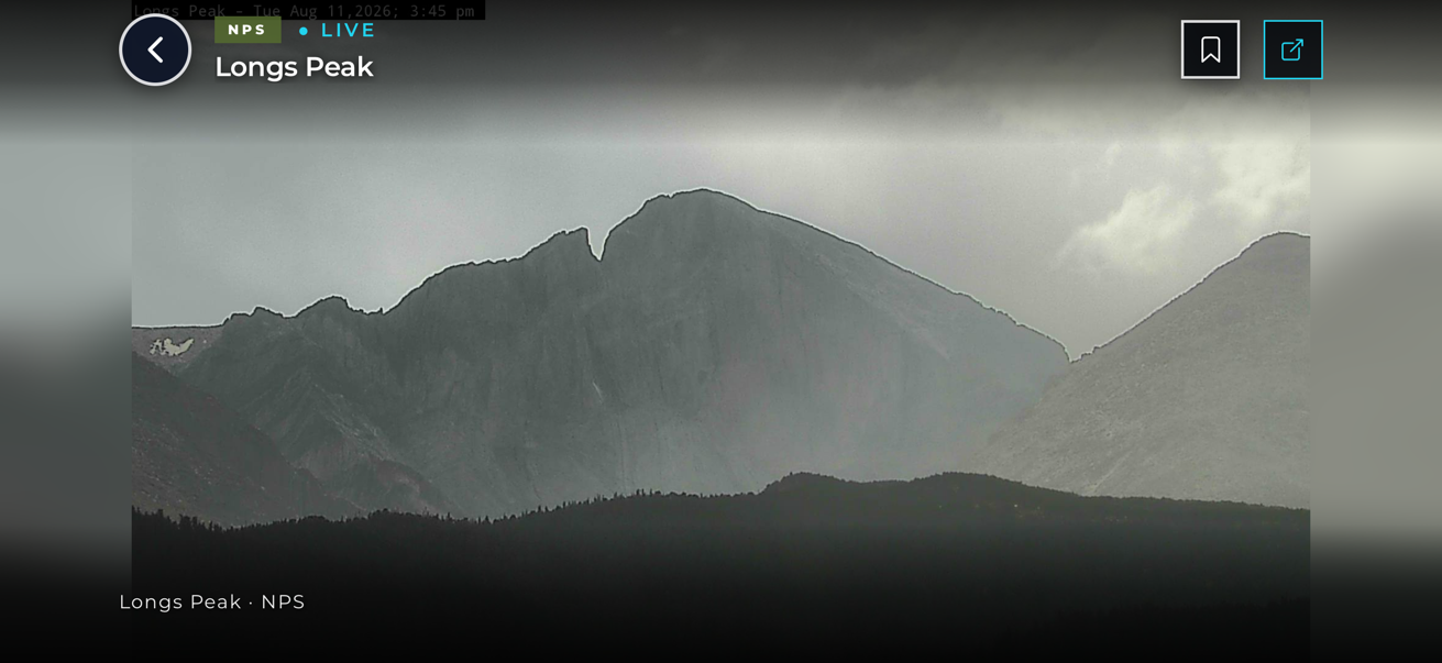
Live camera view of the Diamond face of Longs Peak under storm light, seen full-screen in UpCanyon
Live in the app right now: the Diamond, Longs Peak.
01 · Home

Your home screen is a live camera.

Open the app and you’re looking at the sky: a real camera near you, not a stock photo. It picks one automatically; swap it for any camera you like from the map. No camera nearby? You get a clean weather animation instead.

What’s next, in plain words: the card under the camera reads the nearest real station and tells you what is about to change and when, like “showers possible by 3 PM,” not “40% chance today.”

Name your places. Save home by typing your address, call it whatever you like (Home, Cabin, the Farm), and tap once to swap between there and wherever you’re standing.
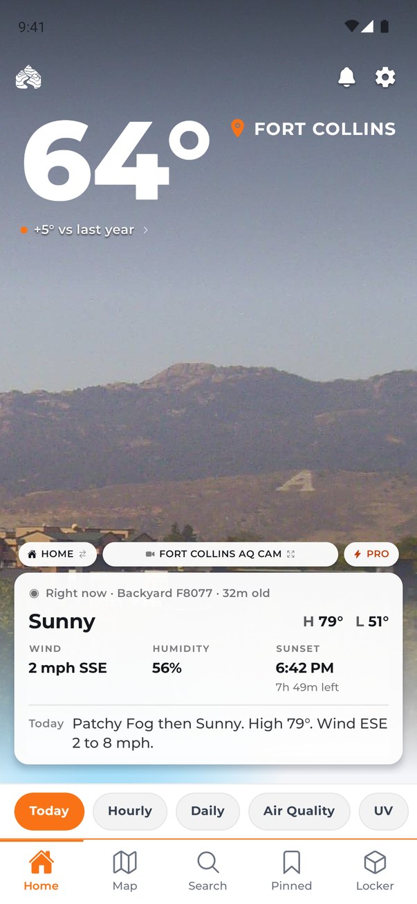
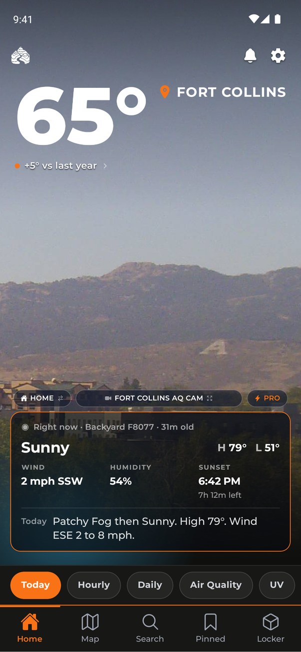
UpCanyon home screen: a live Fort Collins camera behind the current temperature, with a card showing sunny, wind, humidity, sunset and today's forecast
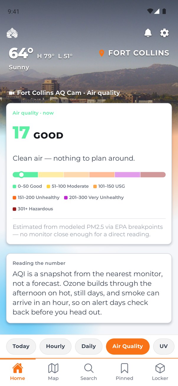
Air quality page showing an index of 17, Good, on a color scale with a plain-language note
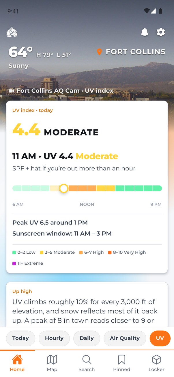
UV index page showing the current UV, the day's curve, the peak hour and the sunscreen window
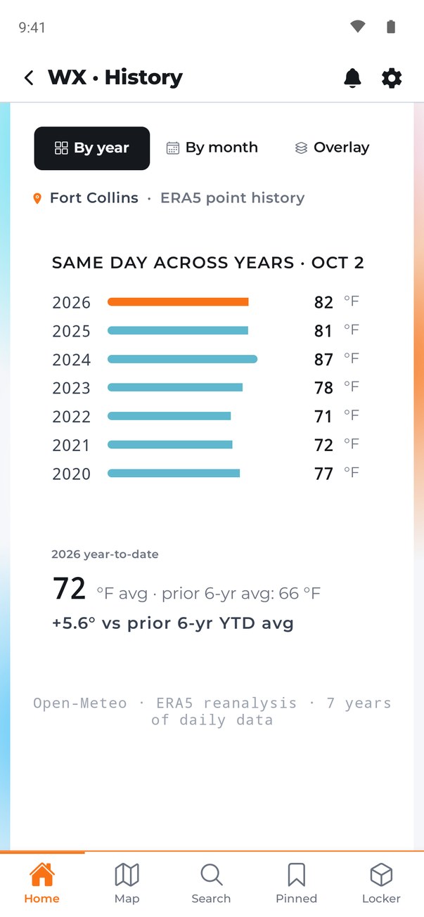
Weather history comparing this same date across seven years

Air quality and UV with its peak window, one tap from home. Pro adds years of history behind every reading.

02 · Radar

Watch the storm, not the forecast.

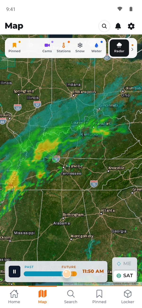
Open the map and put the radar in motion. Scrub it backward to see where the storm has been, forward to see where it is headed.

Then layer live cameras on top of the radar and look inside the storm: pick a camera under the cell and see what is actually falling.

Live radar showing a line of storms from Memphis to Louisville, with a past-to-future time scrubber
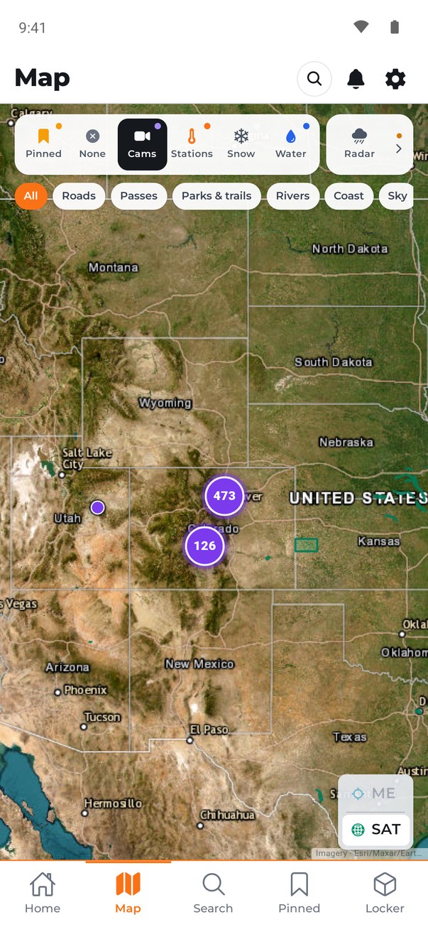
Map of the western United States with clustered camera counts
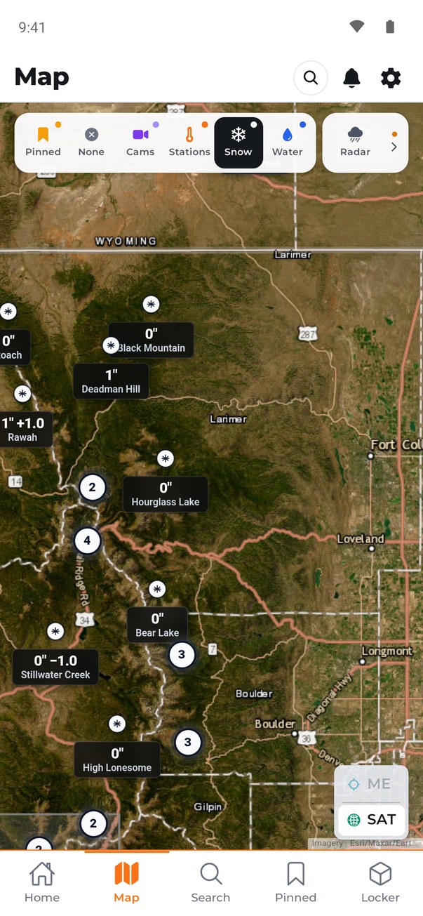
Snow layer showing snow depth at SNOTEL sites across the Northern Colorado mountains
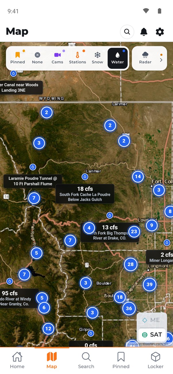
Water layer showing live river flows on gauges around the Poudre and Big Thompson

One map, every layer: 30,000+ cameras · snowpack · river gauges reporting real flow.

03 · Stations

The weather on your street, not at the airport.

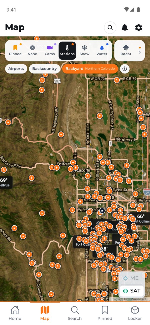
The Stations layer sorts every reading by where it comes from: Airports, Backcountry, and Backyard. Backyard stations are real instruments at people’s homes, in the canyons and small towns where no official station exists.

Tap any station for its live reading and its forecast. Pin the one closest to you and check it in one tap.

Map of Fort Collins and Laporte covered in backyard weather station pins
04 · Lists

Save the places you care about.

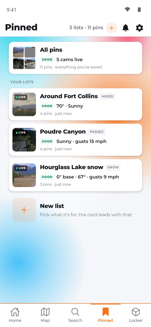
Build lists (the pass you drive, your climbing spots, the town where your parents live) and check on all of them in one glance: live cams, current conditions, and an alert when something changes.

They follow you. Sign in with Apple or Google and your pins, lists and places land on any phone you pick up. Signing in is optional, and the app works the same without it.

Pinned screen with three lists, each showing a live camera thumbnail and one line of current conditions
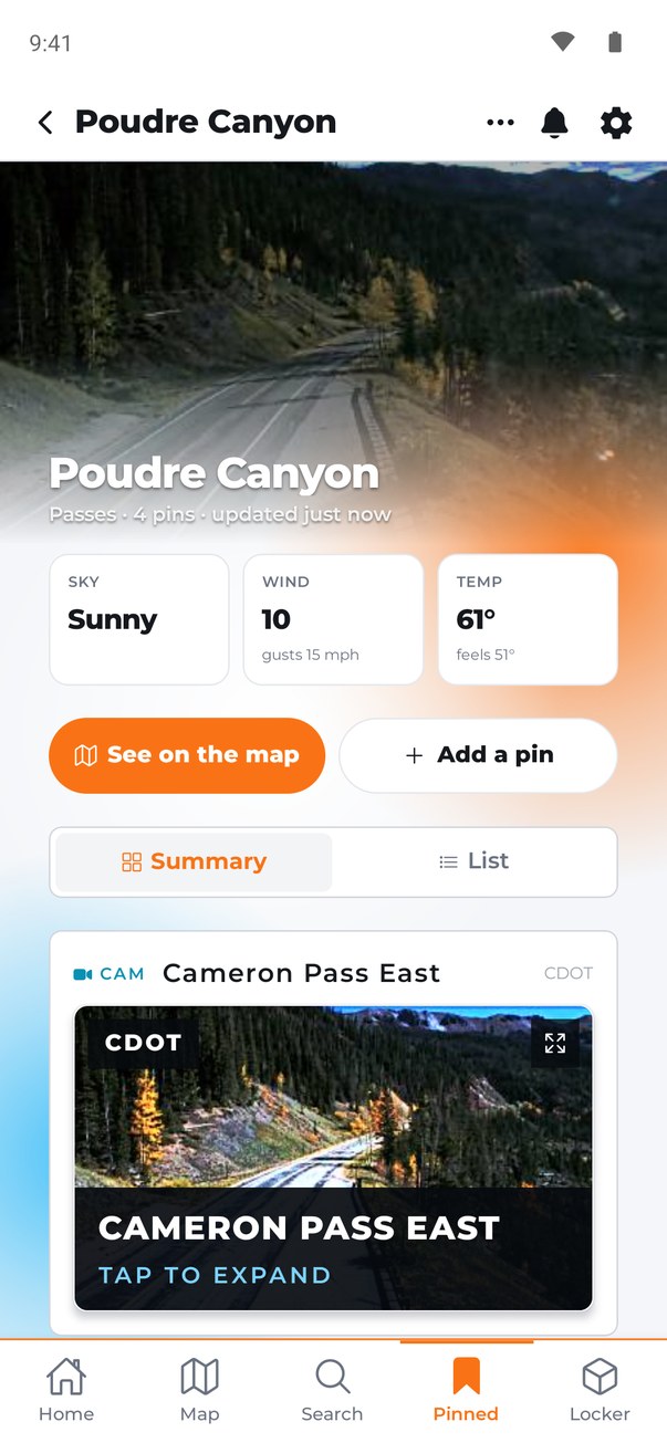
A list called Poudre Canyon with sky, wind and temperature tiles above a live Cameron Pass camera
05 · Themes

Day, night, and eight ways to wear it.

Pick a theme and the whole app changes color with it. Most come in day and night, and Auto switches with the sun where you are. Camera images and warning colors never change. Themes come with Pro.

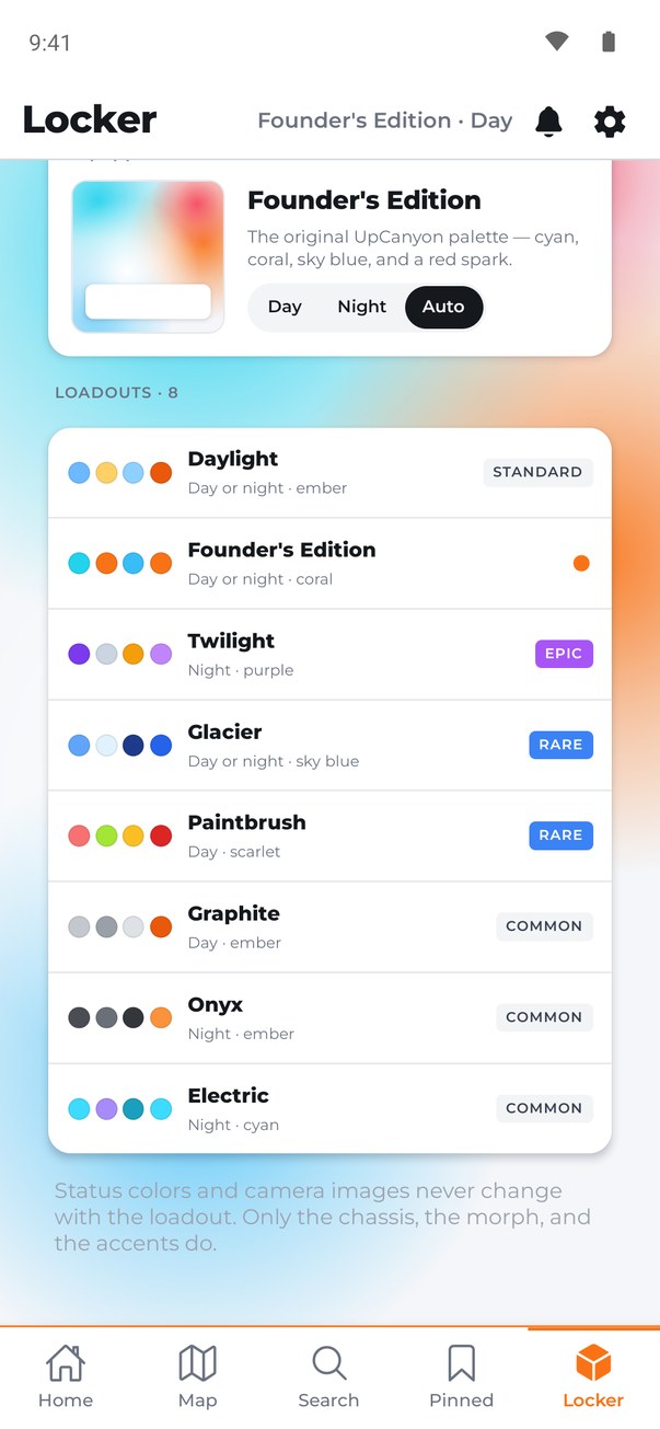
The Customize screen in the day theme, listing eight themes with their color swatches
The home screen in the night theme
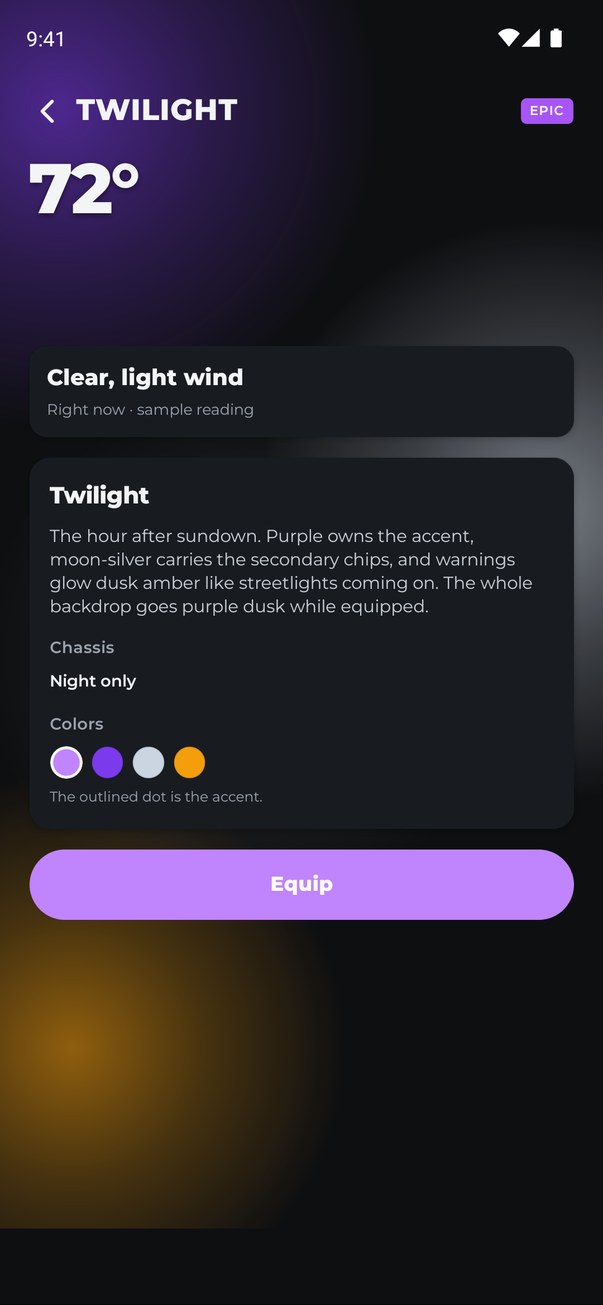
A preview of the Twilight theme: deep purple with amber accents

The same app in Founder’s Edition by day, by night, and in Twilight.

06 · Anywhere

And it works anywhere in the country.

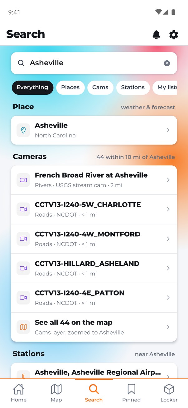
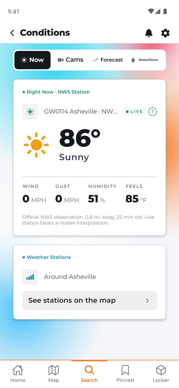
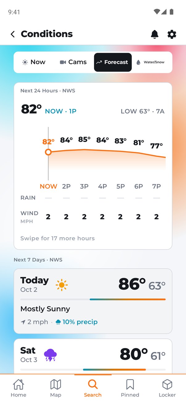
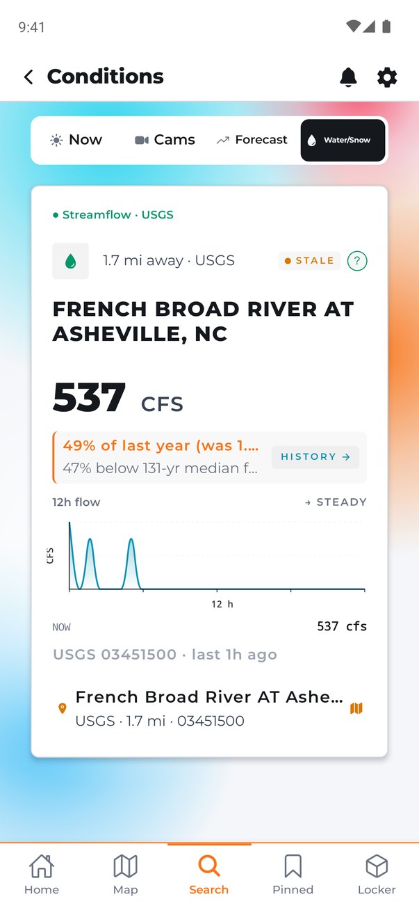
Search any US town and get the same treatment. Here is Asheville, North Carolina: 44 cameras within ten miles, conditions from a station under a mile away, the forecast, and the French Broad River gauge with its history.

1Search
Search results for Asheville: the town, 44 cameras within 10 miles, and nearby stations
2Conditions
Current conditions for Asheville from a National Weather Service station less than a mile away
3Forecast
Hourly and seven-day forecast for Asheville
4River gauge
The French Broad River gauge at Asheville with its flow chart and a comparison to last year

Search → conditions → forecast → the river gauge. Every number sourced, everywhere in the US.

07 · Free and Pro

Free is the whole app, for three places.

Every camera, every station, the radar, the forecast: none of it is behind a paywall. Free gives you three live pins and three alerts. Pro is for when you care about more than three places.

Free
$0
  • 30,000+ live cameras in all 50 states
  • Weather stations, radar, snowpack and river gauges
  • Forecast, air quality and UV
  • 3 live pins and 3 alerts
  • One saved place, plus wherever you are
  • Sign in to keep your pins on every phone
Pro
$4.99 a month
or $44.99 a year · or $99.99 once, for life
  • Unlimited pins and lists
  • Unlimited alerts, aimed at the exact station or gauge
  • Years of history on every station, gauge and snow site
  • Compare any station with where you are, side by side
  • More saved places: the cabin, the in-laws, the office
  • All eight themes

Your first 7 days are Pro, free. No card, and nothing renews by itself. When the week ends you’re on Free, and your extra pins are kept, not deleted.

For your business

Your conditions, on your TV, all day.

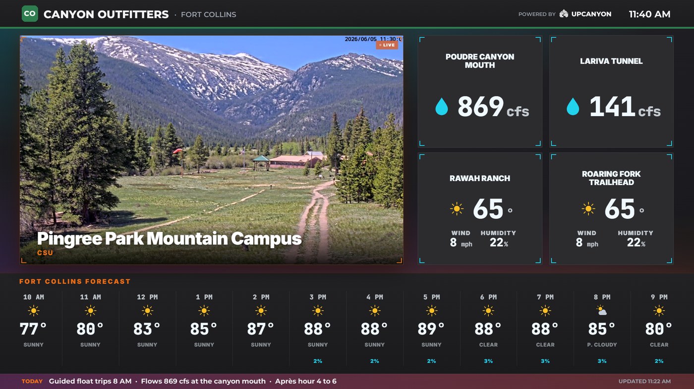
Run a taproom, a gear shop, a lodge? Your customers ask “what’s it like up there?” every hour. Put the answer on the wall: the cameras, snowpack, river flows and forecast they care about, with your name on it.

We send a streaming stick set up for your spots. You plug it in, and the screen is on whenever the TV is. We’re setting up the first ten locations now.

See how it works

A TV dashboard branded for a shop: a live mountain camera, river flows, temperatures and the hourly forecast
Fort Collins, Colorado

Built by one person who lives here.

UpCanyon is built in Fort Collins, Colorado, by someone who drives the Poudre, checks the snow, and got tired of forecasts that stop being true at the mouth of the canyon.

The app is free to use: live stations, cams, radar, and alerts included. Pro adds unlimited pins and alerts, multi-year history, and more saved places, with a pay-once Lifetime option and a free week that never turns into a charge. When the week ends, it just ends.

UpCanyon reads from the sources that report the ground truth — NOAA and the National Weather Service, USGS river gauges, USDA SNOTEL snowpack, EPA AirNow, state DOT cameras, NIFC wildfire data — and shows you where every number came from. Your location is used to fetch your weather, and for nothing else. Signing in is optional; if you do, we keep your email and a backup of your pins, and you can delete both from inside the app.

Questions, ideas, a cam we’re missing?

hello@upcanyon.app — it goes straight to the person who builds the app.